
Official Site: www.houdah.com/houdahGeo/
Type: Geocoding Application for photos – embed location information in photos/images.
Latest Version: Version 1.1.6 (20 June 2007)
Cost: Normally $34.95, but $29.95 until Version 1.2 comes out. Version1.x licenses are valid for all later 1.x versions.
Requirements: Mac OS X 10.4.8, a digital camera and optionally a GPS device.
Version History:
Version 1.1.6 – June 20, 2007: Loading images from iPhoto could crash HoudahGeo.
Version 1.1.5 – June 19, 2007: full list – MacGenealogy.org
Developer’s Description:
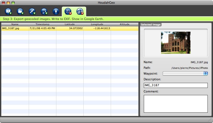
With HoudahGeo you may “pin” photos to the locations where they were taken. The thus created information may be exported to EXIF tags as well as to Google Earth KMZ files. Such a file allows for browsing your photos within Google Earth.
EXIF tagged files are understood by a number of applications and web services. E.g. Panoramio, Flickr,…HoudahGeo 1.1 also allows for direct upload to Flickr.
No expensive GPS camera needed
HoudahGeo is a pure software solution for geocoding photos with latitude, longitude and altitude information. Just like a GPS camera, HoudahGeo can store this information right within the image file – invisibly with no loss of quality.
Unlike a GPS camera, HoudahGeo allows you to export your photos directly to Google Earth.